Tuesday, March 29, 2005
Block Island
Saturday promised a pleasant day of sunshine and light winds, apparently a perfect day to get some aerial exercise. Pete was available for a few hours so I planned a quick trip down to the coast to get some cross country time in the log book. I've been to Fishers Island a few times, once as a dual cross country trip during my PPL training, and again with a friend last year, and the idea of a pleasant stroll in a coastal village setting appealed to both Pete and I, but the added interest of visiting an unfamiliar airport drew my attention to the east, towards Block Island. The island is about seven miles long and three miles across, and it sits about 15 miles off the coast of Rhode Island. I knew it only by reputation as a popular tourist destination, but I had never been there, either by land or by sea. I did know that it has an airport, and that was enough to get us started. I planned on a flight time of about 40 minutes. Transiting the narrow band of sky between the airspaces of Westover and Bradley, we passed Springfield, made for the Norwich VOR, and then to the Sandy Point VOR at the Block Island airport. Despite the light winds, it was pretty bumpy at 3,500 feet, as the afternoon sun heated the ground. The resulting thermals meant that a firm hand was required to keep Yellowbird on heading and altitude. The skies were clear, and a slight afternoon haze did little to hinder a good afternoon of sightseeing over southern Massachusetts and central Connecticut.
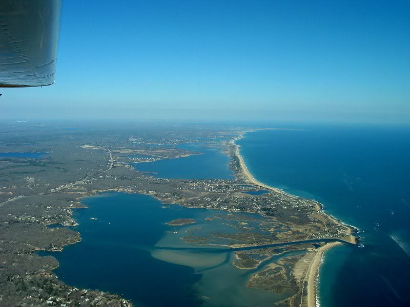 As we crossed the coast and began our descent, the air smoothed considerably, but the CTAF frequency came alive with traffic calls for Block Island and just about every other airport within 100 miles. It took a few minutes to get in my initial report, and I anticipated a busy pattern, but things soon quieted down and we had the pattern to ourselves when we arrived.
  The ramp was well populated with a gaggle of Pipers, a couple of Grummans, a few Cessnas (including a 177RG), a handful of Bonanzas, and a relatively rare Ximango motorglider. The Yellow Truck contacted us on UNICOM as we cleared the runway, and we followed him to one of the few remaining parking spots on the ramp. After paying the $10 landing fee, we set out on foot to explore the island.
Although the airport was busy, the rest of the island seemed deserted. In an hour's worth of walking, we saw only a few residents, some working in the yard, another walking the baby, and a few out enjoying the almost warm afternoon. Making our way back to the airport, we found ourselves on the wrong side of Great Swamp, so a bit of backtracking, including some discrete shortcuts through a few back yards, was required to get us back to the terminal.
 By this time, Bethany's Diner was closed, but we talked them into selling us a couple of sodas before we left. We departed amidst a small flock of other planes, including two of the Pipers, one of the Bonanzas, and the motorglider. The air was smooth and as the pattern cleared out, we took the opportunity to circle the island and do some sightseeing before we headed for the mainland.
 Even in early March, the Island was rich in visual treats, including the intricate coastline, the myriad patches of woods and meadows, and the sometimes jarring juxtaposition of ancient shingle-sided cottages and modern mansions. In the middle of all sits the airport, looking both quaint, with the shingled terminal, and sophisticated, bristling with antennas and weather sensors.
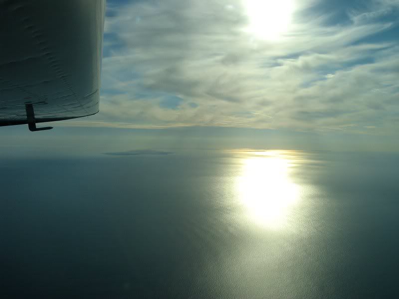 Turning northwards, we climbed to 4,500 feet for our return trip. The late afternoon sun reflected of the waters of Long Island Sound...
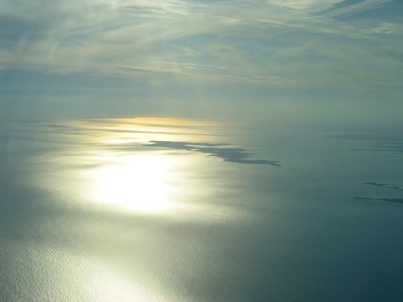 ... silhouetting Fishers Island and the Connecticut coast.
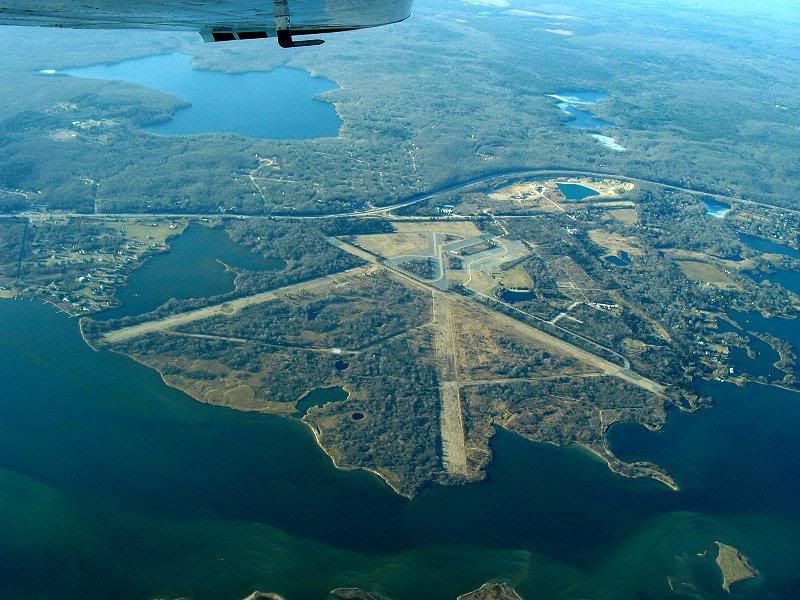 With feet dry again, we took a brief detour to see the old Charlestown Naval Air Station. Very little remains of this historic military base, but the outlines of the runways and taxiways are still much in evidence from the air.
 Resuming our homeward trek, we passed Westerly State Airport. Although it's not nearly as busy as Charlestown NAS was in its day, it was still comforting to see an active airfield. (Note the Cessna departing runway 14)
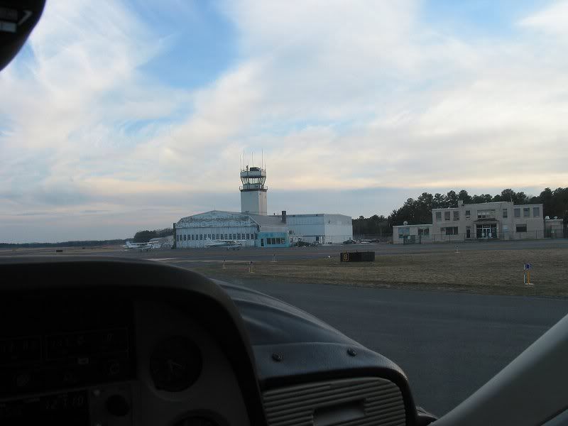 Our return trip was much smoother than the trip down. The lowering sun had little strength to waste on thermal creation, and with Yellowbird trimmed for level flight, I let the autopilot do the flying while Pete and I enjoyed the view and scanned for traffic. Finally, with a little more than two hours on the tachometer, we received clearance for a left downwind for 20. Yellowbird gave us a smooth touchdown and as evening fell, we taxied her back to her familiar tiedown at her own quaint but modern airfield.
The peconic estuary is an incredible place.